Before any Rainwater Harvesting System construction, team Allegiance will help you in identifying the nature of Soil Structure and what is the actual depth to recharge Rainwater. Geohydrological Survey for Rainwater Harvesting is a detailed investigation of the hydrologic and geologic parameters at the subsurface level. It involves the evaluation of the water-bearing levels of rocks and their capability for filtration. Moreover, the intrinsic ability of these rocks to either store or resist water is also assessed.
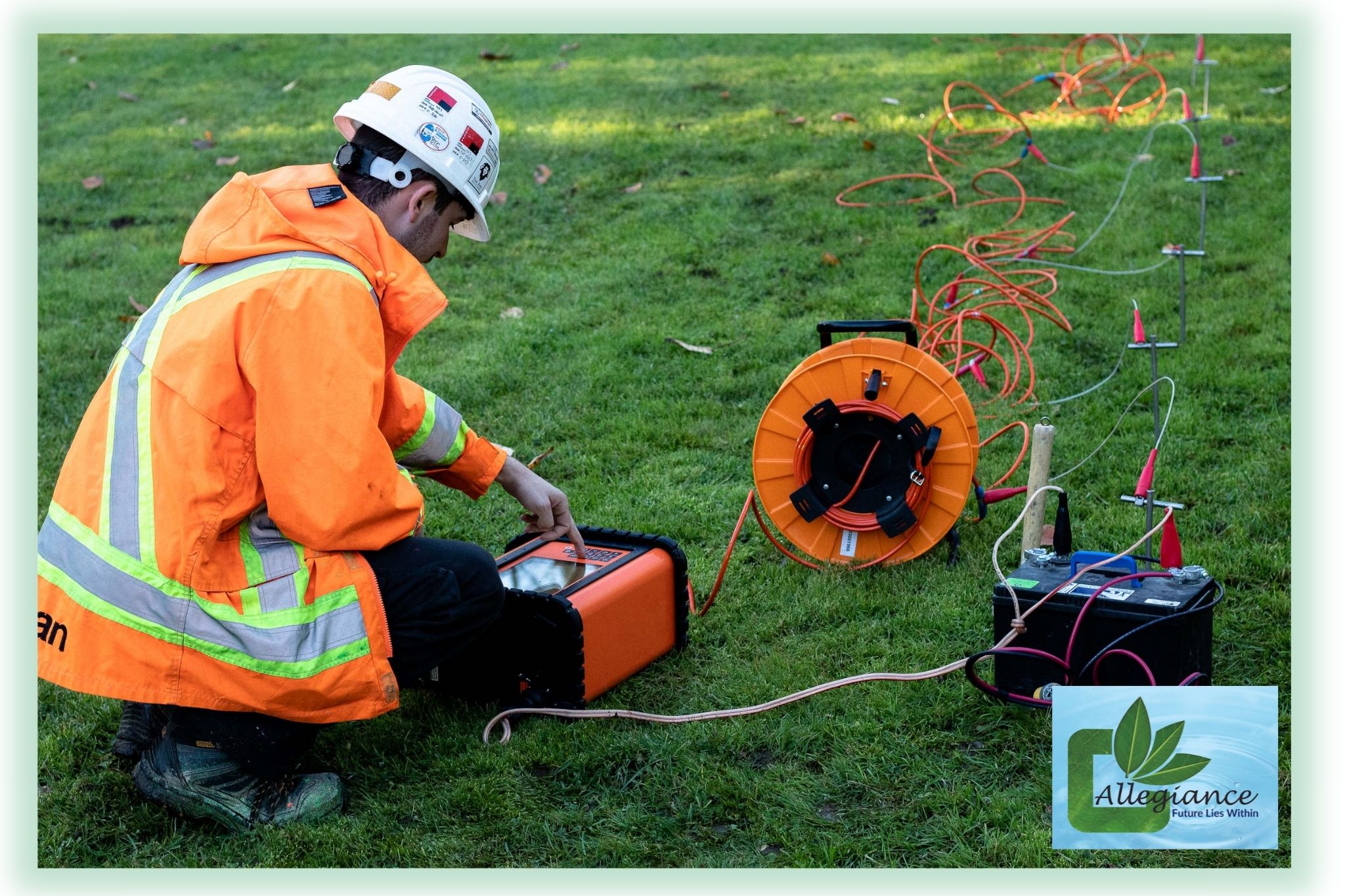
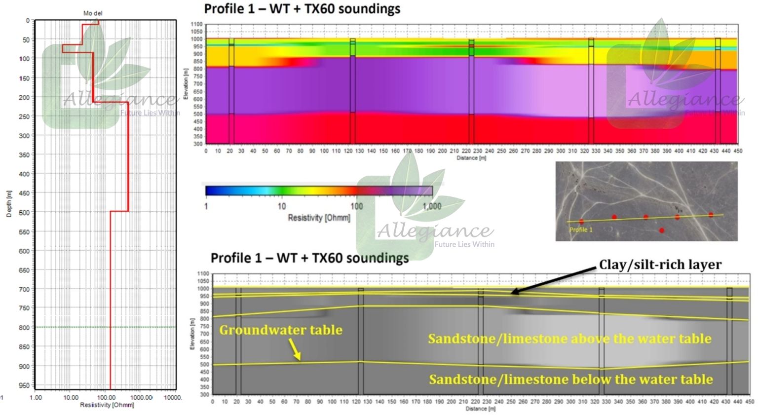
Allegiance Water Management provides a non-destructive and cost-efficient way of gaining a better understanding of the ground conditions by using technically advanced equipment like Resistivity meters & Electromagnetic (EM) VLF instruments. Generally, groundwater has a low electrical resistivity and thus most materials in which water is present will experience a change in resistivity from its original value. i.e. the more saturated a material is, the more its resistivity will change. Through resistivity meters, the chargeability of the ground (how quickly it charges up and subsequently discharges with the application and removal of current) is recorded using time domain induced polarization methods. This can also be very useful in the interpretation of groundwater and differentiation between clay and freshwater. As some aquifers can be found very deep in arid regions, the Geo-hydrological Survey Transient Electromagnetics investigation is able to ‘reach’ depths of 200 – 300 meters, which eventually saves a lot of time, money and energy in locating and drilling potential aquifers. A large loop and high current is used to allow for significant penetration depth from the TEM system that identifies three main layers: a low resistivity top layer of clays and silt, underlain by the local bedrock with relatively high resistivity.
Allegiance Water Management provides high quality service with excellent execution that gives better data coverage than is normally achieved with traditional, discrete, point-by-point geotechnical investigations and sampling, such as drilling or digging.